Thursday, October 02, 2008

October 2, 2008 Media Conference Regarding Recent Arsons and Arrests

The purpose of this News Conference is to review the investigation of numerous arsons and arrests that have occurred over the past month.

A review of all fires within the community over a period of approximately 18 months (March 2007 through August 2008) revealed a significant number of fires, approximately 50, that had occurred throughout the community. The fires ranged from vehicle fires, trash can fires, dumpster fires, outdoor furniture that had been set on fire, grass fires, structure fires and park lands and parks equipment.

During the latter part of August the number and frequency of fires began to increase. As a result, the Grants Pass Department of Public Safety Patrol, Detectives and Prevention, the Josephine County Juvenile Department, Josephine County Parole and Probation, City of Grants Pass Parks Department met and formed a task force to share information and to work together to investigate these fires.

Prior to establishing the task force, Grants Pass Department of Public Safety Detectives and Prevention personnel had spent considerable hours and effort to canvas neighborhoods, collect evidence, and to question many people that may have been involved or have knowledge about the fires.

Citizens of the community has also come forward and offered reward money for the arrest and conviction of the person/s responsible for setting the Morrison Centennial Park fire. The reward rose to $2000.

As a result of the forming of the task force, the Josephine County Juvenile Department shared information that was instrumental in assisting in identifying a possible suspect. Development of that information subsequently led to the execution of a search warrant at Justin Lee Acuff's Bridge Street residence.

Information obtained during this search warrant led detectives to Roseburg, where detectives arrested Justin Lee Acuff and Tristan Canepa. Roseburg Police Department assisted this agency in locating the suspects. We appreciate the cooperation and assistance provided to us by the Roseburg Police Department.

Acuff was arrested for Arson 1, Manufacture and Possession of a Destructive Device and Canepa was arrested for Manufacture and Possession of a Destructive Device.

As a result of these arrests, detectives executed a search warrant at 101 Smokey Lane, the residence of Jonathon Davis. Davis was subsequently arrested on charges of Conspiracy to Commit Arson 1, Manufacture and Possession of a Destructive Device.

The investigation continued with a total of ten arrests and 33 fires being solved over a period of approximately one month. Those arrests included the following subjects:

  1. Justin Lee Acuff DOB: 072393 15 years old
  2. Tristan Loren Canepa DOB: 081093 15 years old
  3. Jonathon Robert Davis DOB: 070790 18 years old
  4. Christian Joshua Pederson-Ilagan DOB: 101992 15 years old
  5. Eric James Cox DOB: 101293 14 years old
  6. Anthony R. Viscetto DOB: 073193 15 years old
  7. Alexander D. Pederson-Ilagan DOB: 090394 14 years old
  8. Sean Kenneth Kemper DOB: 042593 15 years old
  9. Benjamin Jesse Havens DOB: 112292 15 years old
  10. Johnny Walter Amaral DOB: 100794 13 years old

(Acuff, Amaral, and Davis are currently the only subjects still in custody as of October 1, 2008)

One fire that remained outstanding late into September was the Morrison Centennial Park fire that had occurred on July 31, 2008. This fire created a significant and costly amount of damage to the playground equipment, estimated at approximately $40,000.

On September 30, 2008, detectives were able to solve this case with the arrest of Jonathon Davis, Justin Acuff, and Johnny Amaral. Acuff and Amaral were already lodged at the Josephine County Juvenile Detention Center on other arson related crimes.

Davis had previously been arrested and charged on other arson related crimes and had been released from the Josephine County Jail. Detectives went to his residence and arrested and lodged him in the Josephine County Jail.

I have available a spreadsheet that reflects the dates of the fires, case number, location of the fire, what was burned, who the victim was, the amount of damage, who was arrested for the fire, and the charges for each suspect. This should provide a better picture of how in depth this investigation was, how many months that the crimes spanned, and also the pattern that exists between all of the individuals.

As can be seen, Davis and Acuff were involved in the majority of the arsons. In those cases where other arrestees were involved in the fires, either Acuff or Davis were also present and participated.

Specific information is known to this agency as a result of this investigation.

  1. To our knowledge, no one was injured when setting the fires.
  2. To our knowledge, no one was injured as a result of the fires.
  3. These were deliberate fires.
  4. Numerous accelerants and types of manufactured/homemade devices were used.

    At this time we are not discussing the specifics of the accelerants or the types of devices out of concern for the public should others attempt to use these same materials to create devices. Many of the accelerants were common household items, easily obtained chemicals, or accessible fuels.
  5. Many of these fires occurred during night time hours - after curfew (11 pm in City).
  6. Damage, though in some cases limited, still had potential to cause significant damage or harm to other persons or property - as in the case of the urban wildland interface in the area of the old city water tower, "G" Street and Lincoln, "G" Street and Leonard, and NW "B" and NW Woodson.
  7. The reward money was not used for any information obtained that led to the arrests.
  8. In addition to the damage that was initially caused by the fires, estimated at almost $80,000 in the solved fires, there was a significant financial impact for the Grants Pass Department of Public Safety. It is difficult to put an exact time and dollar amount on the cost that this agency bore as a result of this investigation however we know that in excess of 300 hours of investigative and support time was exhausted while interviewing over a hundred individuals, responding to the many fires sites, collecting evidence, canvassing neighborhoods, and conducting follow-up investigations.
This investigation does continue. Several other fires are still under investigation and the potential for additional arrests still exists.

We commend the hard work and dedication of the Detectives and Support Staff that have spent many hours working on these cases. It is because of great team work with the Josephine County Juvenile Department, the Josephine County Parole and Probation, and the Grants Pass Department of Public Safety Prevention and Fire/Rescue personnel that we were as successful in resolving these cases.

I also wish to extend our thanks to the media for their continued interest and attention to this very serious issue.

Arrests made in Morrison Centennial Park Fire

The Grants Pass Department of Public Safety has made three arrests in the arson fire that was set at Morrison Centennial Park on July 31, 2008.

In the late afternoon of September 30, 2008, detectives with the Grants Pass Department of Public Safety responded to 101 Smokey Lane and arrested Jonathon Davis and lodged him in the Josephine County Jail.

Johnny Amaral and Justin Acuff, who were both still in custody at the Josephine County Juvenile Department had the additional charges added.

Tuesday, September 09, 2008

NEW License Issued

IG WPRV395
DOUGALS COUNTY FIRE DISTRICT 2
[APPLICANT IS IN THE BUSINESS OF MEDICAL TRANSPORTATION AND WILL USE RADIOS TO COORDINATE STAFF]
Control Point 1 - 1290 NE CEDAR, ROSEBURG OR 541-673-0632
(link)
09/02/2008 License Modified
1 - 899 MOOREA, ROSEBURG (DOUGLAS) OR (map)
461.625 FB2 150e 20K0F3E
464.475 FB2 40e 20K0F3E
3 - 32.0 km radius around fixed location 1
466.625 MO 90e 20K0F3E
461.625 MO 90e 20K0F3E
464.475 MO 0e 20K0F3E
469.475 MO 0e 20K0F3E
4 - OR Land Mobile Control Station Meeting 20 Rule
466.625 FX1 90e 20K0F3E
467.225 FX1 90e 20K0F3E
469.475 FX1 0e 20K0F3E
5 - CANYON MOUNTAIN, CANYONVILLE (DOUGLAS) OR (map)
462.225 FB2 26e 20K0F3E
6 - 32.0 km radius around fixed location 5
462.225 MO 90e 20K0F3E
467.225 MO 90e 20K0F3E

IG WNDH741
WEYERHAEUSER COMPANY
[APPLICANT IS A MANUFACTURER OF WOOD PRODUCTS]
Control Point 1 - 2186 HANLEY RD, CENTRAL POINT OR 503-772-2010
(link)
09/03/2008 License Modified
1 - 2186 HANLEY RD, CENTRAL POINT (JACKSON) OR (map)
158.28 FB 10e 20K0F3E
2 - 5.0 km radius around fixed location 1
158.28 MO 5e 20K0F3E

PW KNCW554
DOUGLAS, COUNTY OF
[DOUGLAS COUNTY IS A LOCAL GOVERNMENT ENTITY. RADIO WILL BE USED FOR OFFICIAL ACTIVITIES]
Control Point 1 - 1036 SE DOUGLAS AVENUE, ROSEBURG OR 541-440-6111
(link)
09/04/2008 License Modified
1 - ROMAN NOSE, 16.3 KM SE OF, MAPLETON (DOUGLAS) OR (map)
155.805 FB 165e 20K0F3E 16K0F3E
2 - Other
155.805 MO 200e 20K0F3E 16K0F3E
3 - CANYON MOUNTAIN 3KM SSW OF, CANYONVILLE (DOUGLAS) OR (map)
155.805 FB 88e 20K0F3E 16K0F3E
4 - END OF SCOTT MOUNTAIN LOOKOUT RD 5.1 MI NE, GLIDE (DOUGLAS) OR (map)
155.805 FB 165e 20K0F3E 16K0F3E
5 - KENYON MOUNTAIN, 9.1KM SW OF, CAMAS VALLEY (DOUGLAS) OR (map)
155.805 FB 165e 16K0F3E
6 - MOUNT YONCALLA, 3.6KM SW OF, DRAIN (DOUGLAS) OR (map)
155.805 FB 86e 16K0F3E
7 - RED BUTTE, 21.8 KM SE OF, IDEYLD (DOUGLAS) OR (map)
155.805 FB 89e 16K0F3E
8 - 64.0 km radius around fixed location 1
155.805 MO 200e 16K0F3E
9 - 64.0 km radius around fixed location 3
155.805 MO 200e 16K0F3E
10 - 80.0 km radius around fixed location 4
155.805 MO 200e 16K0F3E
11 - 64.0 km radius around fixed location 5
155.805 MO 200e 16K0F3E
12 - 48.0 km radius around fixed location 6
155.805 MO 200e 16K0F3E
13 - 64.0 km radius around fixed location 7
155.805 MO 200e 16K0F3E
14 - (DOUGLAS) OR Countywide
155.16 MO 200e 11K2F3E 20K0F3E

Sunday, August 03, 2008

NEW License Issued to OREGON, STATE OF FIRE MARSHALL

NEW License Issued to OREGON, STATE OF FIRE MARSHALL

PW WQJD347
OREGON, STATE OF FIRE MARSHALL
[FOR MUTUAL AID BETWEEN STATE AND LOCAL AGENCIES.]
07/30/2008 License Issued
1 - OR Statewide
154.2725 FBT 145e 11K2F3E
154.2875 FBT 145e 11K2F3E
155.1675 FB2T 25e 11K2F3E
153.8975 FB2T 25e 11K2F3E
453.025 FB2T 60e 11K2F3E
2 - OR Statewide
150.805 MO 5e 11K2F3E
153.8975 MO 5e 11K2F3E
158.9475 MO 5e 11K2F3E
154.2725 MO 100e 11K2F3E
154.2875 MO 100e 11K2F3E
453.025 MO 25e 11K2F3E
458.025 MO 25e 11K2F3E
155.1675 MO 5e 11K2F3E

Tuesday, July 29, 2008

The funeral for George W. Holmbeck


The funeral for George W. Holmbeck is led by an antique 1927 fire truck

He became fire prevention officer for city of Grants Pass Fire Dept

TIMOTHY BULLARD/Daily Courier

Monday, July 21, 2008

Missing Person

MISSING PERSON:
Riley, Margaret DOB: 11-30-15
WFA, 503, 145, Grey waved hair to neckline, Blue eyes

VEHICLE ASSOCIATED:
1988, Chrysler, 4door, tan or blue in color with Oregon license number PAM405

DETAILS:
On July 14, 2008 Grants Pass Department of Public Safety was notified of a missing person from Regina Way in South Grants Pass. The missing person was identified as Ms. Margaret Riley (see attached flyer). A family member who lives out of the area, made the report to Grants Pass Department of Public Safety. Ms. Riley is 92 years old and has difficulty walking without a walking stick.

She drives a 1988 Chrysler 4 door which is tan or blue in color (similar to attached photograph). According to family members it is very unusual for Ms. Riley to be gone this long without making family members aware.

Anyone who is friends with or has had contact with Ms. Riley within the past 30 days is asked to contact the Detectives Division of the Grants Pass Department of Public Safety at 474-6370.

Monday, May 19, 2008

Sneak Peek at Life Flight's New Helicopter


Sneak Peek at Life Flight's New Helicopter, Coming Summer 2008

Thursday, May 15, 2008

Slow moving carriage may impact traffic


View Larger Map


Horse Drawn Carriage Rides May Impact Traffic on Saturday
Silver Ridge Outfitters, Inc. To Give Rides at Horizon Village
Posted Date: 5/15/2008

On Saturday, May 17, 2008 from noon-2:00 p.m., Silver Ridge Outfitters, Inc., will be giving horse drawn carriage rides at Horizon Village. The slow moving carriage may impact traffic along its route during that time.

The proposed route is as follows:

* The Staging area is on University Road across from Horizon Village in a parking area
* Left on Hubbard
* Left on Canal Road
* Left on Private Property, owned by Horizon Village
* Left on University Road, returning to staging area

Wednesday, April 30, 2008

Honor two Medford firefighters who died


04-30-08 Firefighters from around the state converged on downtown Medford Wednesday to honor two Medford firefighters who died in an ATV accident in the Johns Peak area west of Jacksonville. Mail Tribune / Jim Craven

See the entire gallery that this photo came from!

Thursday, April 10, 2008

Sunday, April 06, 2008

U.S. Forest Service flying drones


The U.S. Forest Service will use flying drones like this one — priced at $50,000 — to track down marijuana growers in remote California woodlands.

Monday, March 17, 2008

OREGON'S LIFE FLIGHT NETWORK TO OPEN TWO NEW BASES


Life Flight Network, LLC is expanding its 30-year presence in the Portland-Vancouver metropolitan area to the Southern Willamette Valley and Columbia River Gorge to bring life-saving medical helicopter service to all communities within range of its new bases of operation. Life Flight's new bases at the Eugene Airport and The Dalles Airport will increase the availability of emergency medical helicopters and fixed-wing aircraft in those regions - reducing the transport time of critically ill and injured patients to area hospitals. "This is great news for the growing communities in those areas," said Michael Griffiths, Life Flight Network Executive Director. "Additional Life Flight bases at the Eugene Airport and The Dalles Airport will not only greatly enhance access to air ambulance service for the communities surrounding those airports, it will have the added benefit of increasing access to Life Flight helicopters in the Portland-Vancouver metropolitan area. Positioning helicopters in the Gorge and Southern Willamette Valley will increase the availability of Life Flight helicopters currently located in Hillsboro and Aurora. With increasing traffic congestion on our freeways, it is getting even more challenging to get patients where they need to go in the shortest amount of time possible." Physicians, nurses, paramedics and other emergency medical providers throughout the region are excited about this new level of service. Traumatic injuries have commonly been the biggest users of medical helicopters, but as treatment options are expanded for patients suffering heart attacks and strokes Life Flight is seeing a greater need for its aircraft. New treatments for a patient experiencing a heart attack or stroke are often times just as time sensitive as getting a trauma patient into surgery. Life Flight plans on beginning service at both of their new bases by mid June. About Life Flight Network – Life Flight (www.lifeflight.org), a CAMTS certified program, is headquartered in Aurora, Oregon. Life Flight was the first hospital based air ambulance on the West Coast and only the fourth such service in the nation. Celebrating 30-years of continuous service, Life Flight has safely transported over 31,000 patients. Life Flight Critical Care Nurses and Paramedics are trained in the emergency transport of high-risk obstetrical patients as well as critically ill and injured pediatric and adult patients. Life Flight Network is owned and operated by the consortium of Legacy Emanuel Hospital & Health Center, Oregon Health & Sciences University, and Providence Health System. Air Methods Corporation, the largest provider of air ambulance pilots and mechanics in the country, holds operational control of Life Flight's helicopters. Aero Air, LLC, widely known for its fixed-wing air ambulance operations, holds operational control of Life Flight's fixed-wing aircraft.

Life Flight Network Eugene Airport in June.

Emergency medical helicopter service coming to Eugene

Monday, March 17, 2008


The business of saving lives often involves a race against time.

And beginning this summer, critically ill and injured patients in Lane County will be able to depend on quick responses from emergency medical helicopters stationed around the clock in Eugene.

Springfield officials — who administer the local FireMed ambulance membership program — have signed an agreement with Life Flight Network of Aurora to begin offering emergency air transport from the Eugene Airport in June.

For the past two years, FireMed has contracted with REACH Air Medical of Santa Rosa, Calif. for emergency air service. The main drawback of that arrangement is that REACH’s closest helicopters operate out of Corvallis.

Officials say once Life Flight touches down in Eugene, local response times should be cut by about 15 minutes.

Read more in Tuesday’s Register-Guard.

Monday, February 25, 2008

School Letters Mobilizes Rescue


School Letters misidentified as plane wreck ..

Wednesday, February 20, 2008

FEMA Grant for Upgrade of GPFire/Rescue Radios

The Grants Pass Department of Public Safety has received a grant from the Federal Emergency Management Agency (FEMA) to upgrade radios for the Fire/Rescue Division. The funding will replace hand-held and mobile radios that are an old mix of manufactures and types. The new radios will be compliant with federal regulations which require public safety agencies to switch to narrow band frequencies by the year 2013. The current radios used by the firefighters are not adaptable to the new standard. Jackson County Fire Agencies as well as the Oregon Department of Forestry in Josephine County have already switched to radios that meet the new standard.

The total cost of the communications grant programs is $123,000.00. The grants will provide $110,700.00 and the Department's matching portion is $12,300.00. This will provide for twenty (20) hand held and seven (7) mobile radios along with a radio repeater that will enhance reception and transmission of emergency radio traffic.

This much needed upgrade will allow firefighter radio transmissions to be clearly heard in all of the city as well as the Urban Growth Area. For years the national fire service has cited poor radio reception as a contributor to numerous fire fatalities and injuries. One feature of the new hand held radios will be a "May Day" button that has a distinctive tone that will notify emergency scene commanders and dispatchers in the event of a firefighter becoming disoriented or trapped. These new radios will meet the needs of the Department as Grants Pass continues to expand its geographical boundaries.

The Aid to Firefighters Grant (AFG) program is administered by the Department of Homeland Security through FEMA and was created a number of years ago by Congress to fund firefighting equipment, health and safety programs and educational programs in fire departments across the nation.

Sunday, February 03, 2008

Saturday, February 02, 2008

140 mile stretch of Interstate 5 Closed

I-5 is closed at Ashland Exit 14 due to blizzard conditions and crashes in northern California. The earliest estimate to re-open is Sunday morning.

NB I-5 is also closed in Redding California. The entire 140 mile stretch of Interstate 5 from Ashland, Or to Redding, CAL is experiencing severe winter weather.

Monday, January 28, 2008

SNOW IN Rogue Valley


Snow hit Rogue Valley look like week of cold .

All Schools are Closed ..... Sunday it Started with Rain then turn to Snow and warm up to 37 f and then Snow then 22F froze and snow ..

MERCY FLIGHTS is flighting mission to Kfalls for transfers to Rogue Valley Medical Center...

Tuesday, January 01, 2008

ODOT Road and Weather Coding

WEATHER CONDITIONS

1 Clear, No Precipitation
2 Partly Cloudy
3 Overcast
4 Ground Fog
5 Intermittent Showers
6 Rain
7 Snow flurries
8 Snowing Hard and Continuously
9 Severe Weather Alert (Dust Storm - Blowing Snow - White Out - Freezing Rain - High Winds - Falling Trees etc)


ROAD SURFACE CONDITIONS

1 Bare Pavement
2 Spots of Ice
3 Black Ice
4 Standing Water or Flooding on Roadway
5 Slush or Pack Breaking up
6 Packed Snow
7 Intentionally left blank
8 Conditional Closure Chains Required - Traction tires are not sufficient
9 Highway Closed

You might hear a report like this: 12-37 for Santiam Pass - 22-76-2-68-C...The first numbers are the temperature, 22 degs. The second set are the weather then the road conditions, in this case Snow Flurries, Packed Snow. The 3rd number is new snow, the 4th number is roadside snow and the last letter is the current Chain Requirement, in this case Chains or Traction tires required.

Tuesday, July 03, 2007

BAILEY CREEK FIRE CONTAINED


The 250-acre Bailey Creek Fire is 100 percent contained as of this morning. Night shift fire crews completed the fire line and day shift crews are laying hose and attacking hot spots. The fire is located west of the lower Rogue River in the Bailey Creek drainage, 2.5 miles north of Galice.

Four helicopters will continue dipping water from the Rogue River today, so river users are advised to proceed with caution north of Galice. The Merlin-Galice Road will also have fire-related traffic on it, so motorists are advised to drive with care through the fire area.

Fallers are being used today to cut hazardous trees.

The Bailey Creek Fire started Sunday, July 1, and is burning primarily on land managed by the Bureau of Land Management.

Monday, July 02, 2007

Bailey Creek Fire

25 miles northwest of Grants Pass, OR. This grass, brush, and timber fire was caused by a vehicle fire which spread into the wildlands, near the Bailey Creek drainage, just off the Rogue River and near the Rand Visitor Center and Campground. The fire occurred in rugged, steep and inaccessible terrain, and spread quickly. Several retardant drops from a P-3 Airtanker were required, and the use of retardant was beginning to show results by early evening. As of this morning (7/02) the fire was estimated at 120 acres in brush, grass, and scattered timber. Several resources have been ordered for this incident, including; numerous contract engines, T2 I.A. crews, and medium and heavy helicopters. Some structures were initially threatened, but, continuing air tanker drops secured those buildings at least temporarily.

Bailey Creek Fire

Started By Car Fire location is 34s -8w 13 sec.

fire is in Heavy Timber push by 15 mph winds and fire as two heads north and south from
Bailey Creek.

3 Helicopters
1 Lead plane 51
1 Tanker 21
1 Air Tac


151.145 ODF

159.240 ODF TAC 2
151.310 White net Air to Ground
124.875 Air to Air Helicopter
132.325 Air to Air Tanker
151.340 Red Net

Monday, December 04, 2006

FOUND Kati Kim and daughters

Kati, and daughters are found in Black Bar in Agness Oregon .

James left on Saturday for help...

Kati and Daughter were Airlift to Merill Airport and transport by AMR to TRH

SAR OPS 155.805

Air to Air 123.450

Sunday, December 03, 2006

Search For KIM Family in Bear Camp Road

12/04/2006 Grants Pass, Oregon

Josephine and Jackson County SAR Team heading back to Bear Camp Road Area due to Cell phone Id to Glendale Cell Phone Tower.

155.805 SAR Base
154.830 Josephine SO

Friday, December 01, 2006

James Kim Search Move to Josephine County

Look like Search move to Bear Camp Road Area . Road area is a white knuckle drive in the summer, looks like sort cut to Oregon Coast but if you like 30 feet roadway make of hard ball and 10 feet of Snow .....

Josephine SO 154.830
Josephine SAR 155.160
Oregon State SAR 155.805
OSP 155.785
Grants Pass Airport 122.800
Rogue Valley Airport 124.300 App/Dep Tower 119.400

FAA TC 121.400 , 124.650 , 135.150

Family missing after trip to Oregon


A San Francisco couple who took a road trip with their two young daughters to spend Thanksgiving in the Pacific Northwest did not return as expected Monday and are now considered missing.

San Francisco police are asking the public's help in locating James and Kati Kim and their two daughters, Penelope, 4, and Sabine, 7 months. The family was last seen in Portland, Ore., on Saturday.

"It is really unusual for them not to call,'' said Ryan Lee, a longtime friend who had brunch with the family Saturday in Portland. "I don't want to let myself think that they are hurt. Apparently, I was the last person who knows them to see them, which is freaky.''

The Kims told Lee that they planned to stop by a clothing boutique in Portland, then drive to Gold Beach on the southern Oregon coast. They told him they had a hotel reservation there for Saturday night, Lee said.

"That was the last I heard from them,'' he said.

It is not known whether the family showed up at the hotel.

James Kim, 35, a senior editor at CNET, lives with his wife and daughters in Noe Valley. The couple own two small stores in San Francisco -- Doe, a clothing store on lower Haight Street, and the Church Street Apothecary in Noe Valley, which sells baby goods and organic skin care products.

Eva Kim, James' sister in San Francisco, said she last spoke to the family the day before Thanksgiving.

She said the family spent Thanksgiving night in Seattle with James' uncle and aunt, Clint and June Youn.

"We had a turkey dinner -- everybody was happy,'' said Clint Youn by phone Thursday night. "I'm very worried, but I'm waiting for good news. I hope nothing happened.''

Two days later, the family met with Lee for brunch in Portland.

"I hadn't seen them in about a year, so we had a lot to catch up on,'' said Lee, a customer support representative who moved to Portland from San Francisco two years ago. "We sat around and ate brunch and played with the kids. ... Everything was fine. They seemed happy, they talked about someday moving to Portland, getting a change from San Francisco.''

Back in San Francisco, Charlene Wright, an employee of the Apothecary store who was house-sitting for the Kims, had expected to hear from them Monday.

"Normally when Kati is out of town, she calls the store five or more times a day,'' said Wright. "But she didn't call'' Monday.

By Tuesday, Wright began to worry, and Wednesday morning, she filed a missing person's report.

Wright said authorities have told her that the last outgoing calls from the Kims' cell phone were Saturday around 2 p.m.

"Everyone has a theory ranging from the not positive to the overly optimistic,'' said Wright. "The prevailing theory is that they got caught in bad weather and can't phone.''

The Kims were driving a 2005 silver Saab station wagon with a personalized California license plate, "DOESF.''

San Francisco police ask that anyone with information on the family's whereabouts contact Inspector Angela Martin of the Missing Persons Unit at (415) 558-5508, or the operations center at (415) 553-1071.

Wednesday, November 08, 2006

City of Grants Pass 2 New Fire Stations


17-17 GRANTS PASS
Yes . . . . . . . . . . . . 5,767 53.90
No. . . . . . . . . . . . . 4,933 46.10
Total . . . . . . . . . 10,700
Over Votes . . . . . . . . . 3
Under Votes . . . . . . . . . 593

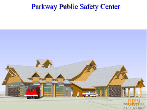
Two new Fire Station one on the Parkway and Redwood and three engines.

Wednesday, July 26, 2006

BOULDER INCIDENT FIRE

124.075 (BOULDER INCIDENT FIRE)US FOREST SERVICE MEDFORD FIRE CENTER

Tuesday, May 09, 2006

Oregon State Police Dodge Chargers


The OSP's Patrol Services Division recently purchased 45 2006 Dodge Chargers for patrolling Oregon highways. Forty-three new Dodge Chargers will be marked in the familiar "OSP Blue" body color with bright yellow graphics, door star emblems, and overhead light bars. Two vehicles will be equipped unmarked patrol vehicles as part of the Department's Aggressive Driving Plan program.


Thursday, May 04, 2006

Siskiyou National Forest L Street Compound Closed

L street radio shop sign off the air today 2:14 pm 171.3875 .....

75 plus years L street Compound is Closing and moving to Medford Oregon

L Street Compound was built by CCC

Wednesday, May 03, 2006

Omni Air International Air Tanker

DC-10
Omni Air International has converted a DC-10 into an aerial tanker. After a successful test, the FAA certified this aircraft for firefighting.

DC-10 backed by an Oklahoma air-charter company, Omni Air International, and fitted with a tank built by Erickson Air-Crane of Central Point.

DC-10 hauls 12,000 gallons of water in a tank strapped to its underside. Conventional air tankers haul up to about 3,000 gallons a flight.


Wednesday, April 26, 2006

REACH Air Medical Services CORVALLIS, OR


CORVALLIS, OR – March 8, 2006— REACH Air Medical Services (REACH) is extending its emergency helicopter service to the Mid-Valley area of Oregon to serve the emergent air medical transport needs of the surrounding communities.

REACH’s new base, located at Corvallis Municipal Airport, will provide more rapid response to patients in need of emergent air medical flights from the scene of accidents or from hospitals throughout the region.

We’re excited to be able to extend our services to Oregon,” said REACH CEO, Jim Adams. “For some time REACH has been aware of the growing need for local helicopter air ambulance services to the Greater Corvallis Area.”

REACH will be working in concert with Cal-Ore Life Flight, based in Brookings,Oregon,” added Adams. “Cal-Ore, which has been transporting patients since 1988, currently provides ground and airplane patient transport services.” Having established a collegial relationship, the companies will be able to offer the combined strength of full-spectrum patient transport services: ground, airplane and helicopter medical transport services.

REACH’s new base brings life-saving emergency air transportation to a region that has not had a dedicated air ambulance presence. REACH will assist trauma victims who are far from the region’s emergency facilities. In addition, the new base places a helicopter closer to the hospitals most often requesting a facility-to-facility transfer for patients in need of specialty emergency care.

We know time is of the essence when it comes to saving lives,” continued Adams. “FromCorvallis, we will be able to help the visitors and citizens of the Mid-Valley area to emergently access the advanced care they may need.”

The new service will be established and available for service in early spring of 2006.

We are well into the process of State EMS Aircraft licensing and securing medical and aviation crew quarters at the CorvallisAirport,” commented Adams. “We anticipate a Mid-May launch of this vital service.”

About REACH Air Medical Services: REACH Air Medical Services (www.reachairambulance.com) is headquartered in Santa Rosa, Calif., and provides helicopter and fixed wing patient transportation for critically ill and injured patients from eight California base locations.

Since REACH’s inception in 1987, the company has performed more than 28,000 air ambulance missions and has developed regional specialties in serving pediatric and neonatal patients. REACH offers a membership program, REACH for LIFE.

REACH was one of the first air transport programs to be fully CAMTS accredited (www.camts.org) and has one of the most aggressive safety programs in the air ambulance industry. REACH was the first air ambulance company to receive FAA approval to respond in low-visibility conditions using established GPS routing procedures. REACH continues to be a leader in air ambulance safety, having installed Night Vision Goggle technology into all of its helicopter aircraft fleet.

REACH is privately owned and operated.

Redwood Empire Air Care Helicopter


Tuesday, April 25, 2006

OSP Car Totaled By Pine Tree


By KTVZ.com news sources

An unoccupied Oregon State Police patrol car received substantial damage Sunday when high winds caused a 40-foot tree to fall onto it in the Gilchrist area, troopers said.

The OSP Ford Crown Victoria patrol car was parked at the Gilchrist-area residence of an off-duty trooper when a lodgepole pine tree fell onto its roof. Preliminary estimate indicates the patrol car was totaled as a result of the damage.

Lt. Steve Nork, OSP-Klamath Falls, estimated the tree was approximately 40 feet tall and about 12 inches in diameter at its base.

Saturday, April 08, 2006

Evergreen Supertanker Tour

http://www.evergreenaviation.com/supertanker/photo_pg/drop_04.jpg

Evergreen has invested 3 years and over $40 million of its own money to develop a multi-mission aerial application platform capable of responding to firefighting, weather modification, biochemical decontamination, and oil spill response missions worldwide.

Mission Profiles Include:
• Firefighting
• Weather Modification
• Biochemical Decontamination
• Oil Spill Containment

Evergreen Supertanker Tour

Tuesday, April 04, 2006

Sexton Mtn. fire lookout destroyed, gear damaged


The Oregon State Police Arson & Explosive Section is asking for the public's help in getting tips regarding investigation of a fire and related criminal mischief to numerous buildings and communication equipment on Sexton Mountain in southern Oregon.

As part of the damage the Oregon Department of Forestry fire lookout was destroyed, and Josephine County 9-1-1 and Wolf Creek Fire Department antennas were damaged, impacting emergency communications.

Sometime between 9:00 p.m. and 10:30 p.m. on Saturday, unknown person(s) were involved in activity on Sexton Mountain that led to the criminal mischief and fire damage to buildings, communication towers and equipment. The damage was discovered on April 2nd about 7:30 a.m.

Buildings and communications equipment property of Oregon Department of Forestry, Josephine County, Wolf Creek Fire Department, U.S. Forest Service, Freedom Communications, and a private ham radio operator were damaged. Preliminary damage estimates are over $100,000.

OSP Arson & Explosive detectives are conducting an investigation are asking for the public's help with information that will lead to identifying suspects in this case. There is no evidence at the scene indicating the fire and associated damage is related to any eco-terrorist activity.

The location of the incident is approximately 7 miles east of Interstate 5 off Old Highway 99 near Jumpoff Joe Creek north of Grants Pass.

Anyone with information regarding this case is asked to contact Oregon State Police Southern Communications Center at (541) 776-6111.

Questions regarding Department of Forestry interests should be directed to Dan Postrel at (503) 945-7420.


Monday, April 03, 2006

ODF Sexton Lookout destroyed


Monday, 03 April 2006
An Oregon Department of Forestry lookout on
Mt. Sexton was destroyed over the weekend
and Oregon State Police are asking for
help to catch the parties responsible.

Numerous buildings and communication
equipment on the mountain were destroyed
sometime between nine and ten thirty p.m.
on Saturday night. Preliminary damage estimates
exceed one hundred thousand dollars.
The location of the incident is 7 miles
east of I-5 off old Highway 99 near
Jumpoff Joe Creek,north of Grants Pass.

OSP Arson & Explosive Detectives
are conducting an investigation
and are asking for the public's help with
information that will lead to identifying
suspects in this case. Anyone with information
is asked to contact

Oregon State Police Southern
Communications Center at (541) 776-611


7th street Bridge Closed for 22 Days

Grants pass Oregon

The 7th St bridge at Park St. will be closed from April 3 to April 24. Expect delays, use alternate routes during peak travel times. All work is weather dependant. Work continues at Park, Lewis, and 6th st. delay + 20 minutes

traffic grid lock ......

155.4750 OSP OPS
154.7850

Sunday, March 26, 2006

Air Life of Oregon New Eurocopter EC-145

Sisters Airport Monday, April 10

Air Life of Oregon
to provide orientation and safety training on the new EC-145 helicopter for local emergency medical services agencies

An Air Life of Oregon crew (flight nurse, respiratory therapist and pilot) will fly the program's new EC-145 helicopter to Sisters to orient emergency medical service personnel to the new helicopter Monday, April 10. The orientation will take place at 6:00 p.m. at the Sisters Airport. The public is invited to attend and view this new valuable resource for the community.

The crew will demonstrate how to load and unload patients, introduce added safety features of the EC-145 and demonstrate the physical landing zone requirements needed for the new helicopter. The orientation and training schedule will be coordinated by Bill Porter, RN, EMT-P and Clinical Operations Manager for Air Life. Air Life's 15-year-old Bell 222UT will retire shortly. With parts getting harder to locate and expensive, the program spent two and a half years to research the best choice for replacing the helicopter.

Photos at http://www.duaneanderson.net/n885al

http://web.newsguy.com/n7ddaweb/N885AL_19.jpg

Eurocopter EC-145 photo By Duane Anderson Coryright 2006


image


15-year-old Bell 222UT will retire shortly

Saturday, March 18, 2006

Pirates opened fire on the Navy ships

Combined Task Force Five Eight (CTF-58) flagship, the guided missile cruiser USS Cape St. George (CG 71) provides support for U.S. and Coalition Forces in the region.
From U.S. Naval Forces Central Command Public Affairs

ABOARD USS CAPE ST. GEORGE, At sea (NNS) -- USS Cape St. George (CG 71) and USS Gonzalez (DDG 66) returned fire on a group of suspected pirates in the Indian Ocean, killing one and wounding five, approximately 25 nautical miles off the central eastern coast of Somalia in international waters at 5:40 a.m. local time, March 18.

Cape St. George, a guided-missile cruiser, and Gonzalez, a guided-missile destroyer, were conducting maritime security operations in the area as part of Combined Task Force 150, a maritime coalition task force currently led by Royal Netherlands Navy Commodore Hank Ort, when they spotted a suspect vessel towing two smaller skiffs heading west toward the coast. As Gonzalez’s boarding teams prepared to conduct a routine boarding of the suspect vessel, the two Norfolk, Va.-based Navy ships noticed the group of suspected pirates were brandishing what appeared to be rocket-propelled grenade (RPG) launchers.

The suspected pirates then opened fire on the Navy ships. Cape St. George and Gonzalez returned fire with small arms in self-defense.

One suspected pirate was killed and a fire ignited aboard the main suspect vessel. Boarding teams from Cape St. George and Gonzalez took twelve other suspects into custody, including the five injured. The Navy boarding teams also confiscated an RPG launcher and automatic weapons. No U.S. Sailors were injured in the engagement.

The Navy ships are providing medical treatment to the wounded suspects, continuing search and rescue efforts for any additional suspects and collecting further evidence from the vessel and skiffs. Royal Netherlands Navy medical personnel, including a medical doctor, are en route to assist from HNLMS Amsterdam.

Coalition forces conduct maritime security operations under international maritime conventions to ensure security and safety in international waters so that all commercial shipping can operate freely while transiting the region.

On March 15, the United Nations Security Council encouraged naval forces operating off the coast of Somalia to be vigilant and take action against piracy. Pirate attacks against aid ships have hindered UN efforts to provide relief to the victims of a severe drought in the area.

Friday, March 17, 2006

Missing Ashland Family Search

UPDATE : Found at Calvert Peak airstrip which is west of Glendale


The Stivers family was last heard from as it was leaving for an overnight trip on the Oregon coast from Ashland Oregon .

Jackson County SAR started search on March 14, 2006 and cleared Jackson County for 35-foot Dolphin motor home Arizona license plates 171TDH .

Search move Josephine County Bear Camp Road area on march 16, 2006 and call off search on March 17, 2006 early morning due to white out snow storm ..


SAR teams from Oregon and California scoured Highway 199 to .

Bear Camp Road is BLM 34-8-36 and NF 23


155.6100 Jackson SO
154.8300 Josephine SO
155.8500 Statewide SAR
155.1600 Josephine SAR
122.8000 Grants Pass Airport


The children and their parents were last seen on March 4, 2006. Their grandparents, whose photos are not shown, are also believed to be with them. They may be traveling in a 1992 tan Dolphin motor home with Arizona license plates 171TDH.

Saturday, December 24, 2005

DOT 184-05 Kris Kringle Sign Open Skies Agreement

DOT 184-05
Wednesday, December 21, 2005


U.S. Secretary of Transportation Norman Y. Mineta And North Pole’s
Kris Kringle Sign Open Skies Agreement

Agreement Gives Santa Greater Access to Rooftops of Good Kids Everywhere

Just in time for Christmas, Secretary of Transportation Norman Y. Mineta and the North Pole’s Kris Kringle, a.k.a. Santa Claus, signed an Open Skies aviation agreement in Washington, D.C. today, giving Santa and his team of reindeer greater access to the rooftops of good kids everywhere.

For years, Santa had been required to make an annual request to the Secretary of Transportation for a special flight certificate in order to deliver his Christmas goodies. With this new agreement, it will be easier for Santa to finish his job all in one night.

“Santa can now focus on making his list and checking it twice, without the hassle of government paperwork,” said Secretary Mineta. “Thanks to this agreement, the only time he needs to worry about Red Tape is if he wants to use it to wrap presents.”

The Open Skies agreement signed by Secretary Mineta and Santa Claus noted Santa’s safe and efficient toy delivery operation that enables him to bring joy to millions of children in all 50 states, the District of Columbia, Puerto Rico and all U.S. territories, all without impact to air traffic carrying travelers to their holiday destinations.

“Now it’s just HO HO HO and off I go,” exclaimed the Jolly Old Elf. “The reindeer and I look forward to checking this item off of our list for good,” he said.

Mineta said the decision was helped by a flood of public comments offered by Santa advocates from all over the nation. Thousands of letters were sent to the Department of Transportation and to the North Pole encouraging each party to complete these important negotiations before Santa’s yearly trip, he said.

“Santa’s Elves are tough negotiators,” Mineta noted. “But, in the end, we were able to arrive at an agreement that will benefit children of all ages.”

Sunday, December 11, 2005

Oregon Plans for StateWide Trunk System

State of Oregon Plan for StateWide Trunk System useing P25 buy 2010

New Buss Word is : interoperable communications

The The Oregon State Interoperability Executive Council or (SIEC)

WebPage http://www.oregon.gov/SIEC/index.shtml


The following is the SIEC’s guide for programming the FCC designated interoperability
(I/O) channels into existing radios and all new radios that are added to any system.
Due to space limitations in some radios, it may not be possible to program all of the I/O
channels into all radios. In that case, at a minimum, the calling channel and the first
tactical channel should be programmed. The frequencies listed are in each of the
three bands and are listed by order of priority, with highest priority shown at the top of
the list. They are to be programmed into the radios with the highest priority first, as space
permits.
Note: As of January 1, 2005, existing systems on these channels and those existing
systems on the adjacent channels become secondary to these interoperability
channels. In the event of interference, existing systems must cease use when
interference occurs to interoperability channels.

VHF Radios
Channel (MHz) Label Description
155.7525 base/mobile VCALL National Calling
151 .1375 base/mobile VTAC 1 National Tactical
154.4525 base/mobile VTAC 2 National Tactical
158.7375 base/mobile VTAC 3 National Tactical
159.4725 base/mobile VTAC 4 National Tactical

UHF Radios
Channel (MHz) Label Description
453.2125 Base/mobile UCALLa National Calling
458.2125 mobile UCALL National Calling
453.4625 base/mobile UTAC 1 a National Tactical
458.4625 mobile UTAC 1 National Tactical
453.7125 base/mobile UTAC 2a National Tactical
458.7125 mobile UTAC 2 National Tactical
453.8625 base/mobile UTAC 3a National Tactical
458.8625 mobile UTAC 3 National Tactical

800 MHz Radios
Channel (MHz) Label Description
821/866.0125 ICALL National Calling
821/866.5125 ITAC-1 National Tactical
822/867.0125 ITAC-2 National Tactical
822/867.5125 ITAC-3 National Tactical
823/868.0125 ITAC-4 National Tactical
821/866.3250 OROPS1 Oregon Tactical
821/866.3875 OROPS2 Oregon Tactical
821/866.7500 OROPS3 Oregon Tactical
821/866.7750 OROPS4 Oregon Tactical
821/866.8000 OROPS5 Oregon Tactical
867.5375 STATEOPS-1 Washington Tactical
867.5625 STATEOPS-2 Washington Tactical
867.5875 STATEOPS-3 Washington Tactical
867.6125 STATEOPS-4 Washington Tactical
867.6375 STATEOPS-5 Washington Tactical

Saturday, November 12, 2005

AWACS crews watch over president

AWACS support


OVER ARGENTINA -- An E-3 Sentry airborne warning and control system aircraft breaks away from a Mississippi Air National Guard KC-135 Stratotanker during a presidential support mission here. The Sentry, from the 552nd Air Control Wing at Tinker Air Force Base, Okla., deployed to provide airborne surveillance for the Summit. (U.S. Air Force photo by 1st Lt. Corinna M. Jones)


Tuesday, October 11, 2005

Wednesday, August 31, 2005

HURRICANE KATRINA DISASTER RELIEF TFR


CBP P-3, AIRCRAFT CALLSIGN OMAHA 44,
WHICH IS SUPPORTING RELIEF AIR OPERATIONS
DURING 0700-1600 LOCAL IN THE TFR AREA ON
VHF 134.9 OR UHF 282.425 (BACKUP FREQUENCY 123.45)


OMAHA45 FOR FLIGHT ADVISORIES. ADVISORY
FREQUENCY FOR RESCUE OPERATIONS IS VHF 126.875/UHF327.05

Deer Creek Fire Contained

154.175 RMFD
154.190 IVRRD

124.075 Air to Air TFR
133.325 Air Tanker Ops

168.650 NFF
154.830 SO
155.160 SAR
155.805 NSAR
158.820 ODOT
166.350 BLM
171.3875 SNF
154.725 SO TAC

TAC 1
TAC 2
VTAC5
VTAC4
154.100 REC S
155.265 AMR
154.450

Fire Cache System

159.3150 Tac 1
159.2850 Tac 2
159.4050 Tac 3
159.3750 Tac 4
159.4350 Tac 5
159.4650 Input Relay
158.8950 Out Relay
122.9000 Fire Camp LZ.

Rogue Valley Tac Channel's

154.2800 Rogue Valley Tac 1
159.2400 Rogue Valley Tac 2
153.8200 Rogue Valley Tac 3
154.2200 Rogue Valley Tac 4
154.2500 Rogue Valley Tac 5
154.0700 Rogue Valley Tac 6

Friday, August 26, 2005

Deer Creek Conflagration Information


OREGON STATE FIRE MARSHAL INCIDENT ACTIVITY REPORT
1604 hours 08/26/05
Prepared by Donna Disch
OSFM REPORT

TYPE OF INCIDENT: Conflagration

INCIDENT NAME: Deer Creek Fire

DATE AND TIME FIRE STARTED: August 25, 2005 @ 1700

For Conflagration: DATE AND TIME CONFLAGRATION DECLARED: August 25, 2005 @ 20:45 requested by Josephine Fire Defense Board Chief Brian Pike.

LOCATION: 8 miles north of Cave Junction and a few miles east of Selma, OR.

SIZE: 1800 Acres

CAUSE: Under investigation

STATUS: Active: This fire is burning in grass, brush and timber 8 miles north of Cave Junction and a few miles east of Selma, Oregon. The fire burned briefly in a lowland valley on both sides of Deer Creek Road, then moved onto steeper ground and into a more heavily timbered area.

RESIDENCES THREATENED: 102 homes

STRUCTURES THREATENED: 225: 102 homes and 123 other buildings

RESIDENCES EVACUATED: Voluntary evacuation in place. Per Josephine County Sheriff’s Office: Search and Rescue going door to door on Davis Creek, Elliot Creek and Cheny Creek advising of possible voluntary evacuations if the fire jumps; citizens are not denied entry to their homes, but must show ID to get through. Citizens needing medication may get in their homes. Citizens who leave Davis Creek will not be allowed back in until fire behavior is moderate (involves 6-8 homes). An animal shelter has not been requested. The American Red Cross (ARC) has a shelter open at Illinois Valley High School until not needed. ARC reports 4 used the shelter last night.

RESIDENCES LOST: 3 homes; 2 homes have been damaged

OTHER STRUCTURES LOST: 12 other buildings are confirmed destroyed; 6 outbuildings have been damaged

INJURIES/FATALITIES: None known

SPECIAL CONDITIONS: From the time the fire started it was aggressive until 0100 hours when an air inversion decreased temperatures and caused the fire to remain down through early afternoon. As the afternoon progressed, the inversion lifted and the fire became spotty. Fire area is steep rugged terrain with heavy fuel of timber, brush and grass. Winds are 10 – 15 mph with temperatures of 80 – 85 with wind from the west. Humidity is 25-30%.

INCIDENT MANAGEMENT AGENCY (S): Oregon Department of Forestry Lead; OSFM structural lead

STRUCTURAL INCIDENT COMMANDER: Bill Anderson

WILDLAND OR OTHER (STATE WHICH TYPE) INCIDENT COMMANDER: None at this time

AGENCIES INVOLVED IN SUPPRESSION: Illinois Valley, Rural Metro, Jackson County Task Force, (includes Medford, Ashland), Grants Pass, Oregon Department of Forestry (primary to mobilized task forces listed below).

Federal Agencies – None at this time

Other state – California Department of Forestry

Other – Josephine County Sheriff’s Office is managing evacuation and traffic control; the ARC has set up Illinois Valley High School as a shelter for evacuation, Josephine County Emergency Management Search and Rescue are notifying citizens of current evacuation status and providing public information.

OSFM Resources –

Task Force/Strike Team
#of Personnel
# of Equipment
Fire Departments
Lane Co – Task Force #1
2
Command
Lane County #1
Lane Co – Task Force #1
3
Type II Engine
Springfield
Lane Co – Task Force #1
2
Type II Tender
McKenzie
Lane Co – Task Force #1
3
Type II Engine
Coburg
Lane Co – Task Force #1
4
Type II Engine
Goshen Fire
Coos Co – Task Force #1
2
T-5 Tender
Siuslaw Valley
Coos Co – Task Force #1
3
Rar2 Type III Engine
Bandon
Coos Co – Task Force #1
3
QAI Type II Engine
Siuslaw Valley
Coos Co – Task Force #1
3
8314 Type II Engine
North Bend
Coos Co – Task Force #1
5
Type II Engine
North Bend
Linn County – Task Force #1
2
Command Vehicle
Albany/Sweethome
Linn County – Task Force #1
2
Tender
Brownsville
Linn County – Task Force #1
3
Type II Engine
Brownsville
Linn County – Task Force #1
3
Type III Engine
Lebanon
Linn County – Task Force #1
3
Type III Engine
Sweet Home
Linn County – Task Force #1
3
Type III Engine
Lebanon
Klamath Falls Task Force
1
Command Vehicle
Chiloquin
Klamath Falls Task Force
3
Type III Engine
Chiloquin
Klamath Falls Task Force
4
Type I Engine
Klamath FD #1
Klamath Falls Task Force
4
Type I Engine
Kingsly Field
Klamath Falls Task Force
3
Type I Engine
Keno
Klamath Falls Task Force
2
Tender
Klamath County #4
Klamath Falls Task Force

Benton County Task Force #1
2
Command Vehicle
Corvallis
Benton County Task Force #1
2
Tender
Corvallis
Benton County Task Force #1
3
Type III Engine
Corvallis
Benton County Task Force #1
4
Type I Engine
Alsea
Benton County Task Force #1
4
Type I Engine
Philomath
Benton County Task Force #1
4
Type I Engine
Corvallis
Marion County – Task Force #1
Pre-Alert

Task force: one task force leader with command vehicle, capability to refill own water tanks, three type I or II engines with off-pavement capability, one type III engine and one tender.

OSFM INCIDENT MANAGEMENT TEAM: Red Team

Position
Name
Fire Service
Agency Administrator or Agency Representative


IC
Bill Anderson
TVF&R
Deputy IC
Jim Stearns
Hermiston
IIO
Tim Birr/ Elaine Parrott - assisting
TVF&R
Safety Officer
Kent Barnes
Redmond FD
Planning
John Fowler (Steve Frazier-shadow)
Pendleton
Deputy Planning
Al McMahen
Sublimity RFPD
Resource Unit Leader
Charlie Chase
OSFM
Logistics
Scott Goff/ Michelle Stevens - assisting
OSFM
Finance
Bob Wright
OSFM
Ops Chief
John Ketchum
Keno
Deputy Ops
Tay Robertson
Sisters
Div/Grp Supervisors
Doug Koellermeier/Dale Ledyard/Doug Myers

Communications Unit
Bruce Bjerke/Brian Fritsen


ADDITIONAL INFORMATION:

  • Expanded Blossom Fire Incident Command for Deer Creek Incident Command
  • Deer Creek has been declared a FEMA fire: http://www.fema.gov/news/event.fema?id=4785
  • Staging area is Hwy 199; turn on to Deer Creek Rd 2.5 miles to Selmac Lake
  • OSFM website: http://egov.oregon.gov/OOHS/SFM
  • OSFM website conflagration information: http://egov.oregon.gov/OOHS/SFM/docs/Comm_Ed/WUI/WUIR_1_Conflagration_Impact.pdf
  • Road Closures: Deer Creek Rd between Hwy 199 and Dryden; Indian Creek Rd (Off of Draper Valley).
  • 10% contained
  • Operational tactics include aggressive air attacks with retardant and bucket drops with dozer and hand line construction.
  • Fire has potential to expand over 700 acres (1800 + 700 = 2500), depending on wind. Growth potential is high due to difficult (steep) terrain.
  • Fire is on mix of private and Bureau of Land Management (BLM) land.


Expanded Blossom Fire Incident Command for Deer Creek Incident Command

Thursday, August 25, 2005

Deer Creek Road Fire


5 NAUTICAL MILE RADIUS OF 421737N/1233312W


Deer Creek Fire burns at least four homes in Southern Oregon

08/26/2005 kgw.com

By JEFF BARNARD / Associated Press

A fast-moving wildfire burned at least four homes Thursday in a rural area of southwest Oregon.

The Deer Creek fire, which began Thursday afternoon, had burned at least 1,500 acres of dense forest mixed with homes a few miles east of the rural community of Selma, said Illinois Valley Fire District spokeswoman Sandy Humphfries.

Residents of 30 to 40 homes in the area were urged to evacuate. About 200 firefighters, four air tankers, four bulldozers and three helicopters were battling the blaze.

Chip Warner and his wife, Suzie, stood at an intersection and watched as the fire burned up Crook's Creek toward their home.

"My wife grabbed what she could before they evacuated her," said Chip Warner, a construction worker who once served as a volunteer firefighter. "The black smoke means a structure fire. Look at that puff of black smoke. That's right in our neck of the woods."

Warner said he and his wife have spent the last four years thinning the woods on their 10-acre property.

"When you live in the sticks, it's always an issue, but you don't expect it to happen to you," he added.

The Deer Creek fire was burning a few miles south of U.S. Highway 199, and several miles from the massive 2002 Biscuit fire, which burned 500,000 acres and threatened 17,000 residents of the Illinois Valley.

Illinois Valley Fire Chief Harry Rich said the cause of the Deer Creek fire was under investigation.


154.830 SO
155.160 SAR
155.805 Nat SAR
151.1450 ODF Dis.
151.3100 Air Ground
159.2400 Tac

154.1900 IVFD
154.1750 RMFD
154.2500 Tac 5 Lake Shore Ops
154.0700 Tac 6 Deer Creek Ops

166.350 BLM

122.925 IV Airport
124.075 Air to Air
168.650 Nat FF

GOOGLE Map

Tuesday, August 02, 2005

Oregon TFR

  • 123.025 IRISH SPRINGS FIRE JUNTURA, OR VAIL BLM DISPATCH
  • 122.225 MULE PEAK FIRE LE GRANDE, OR VAIL BLM DISPATCH
  • 125.550 DRY CABIN FIRE JOHN DAY, OR MALHEUR NF
  • 123.400 SIMPSON FIRE KLAMATH FALLS, OR ODF
  • 132.3250 BLOSSOM COMPLEX AGNESS, OR SISKIYOU NF
  • 124.0750 RIGHT SARDINE FIRE MEDFORD ,OR ODF